Energy Solutions
Events

Asset Estimation

Aerial Precision for Asset Estimation

Anton Solutions delivers drone-powered asset estimation, helping industries achieve precise measurements, accurate stockpile tracking, and real-time infrastructure assessments. Our UAV (Unmanned Aerial Vehicle) technology provides high-resolution imaging, volumetric analysis, and AI-driven insights for smarter decision-making. Businesses trust us for efficient resource planning, risk mitigation, and optimized asset monitoring. Aerial data collection eliminates manual errors, reducing costs while improving accuracy. Industries gain better control over inventory, site planning, and operational efficiency with our advanced drone solutions.

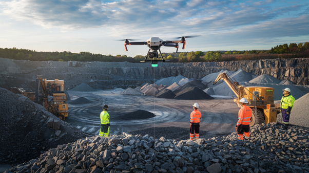
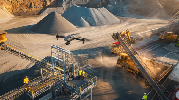
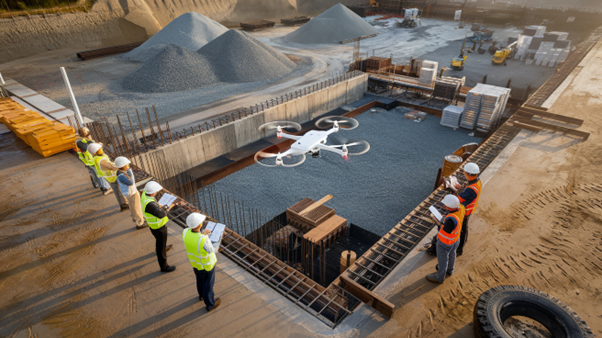
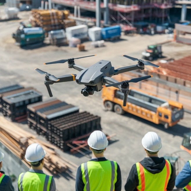
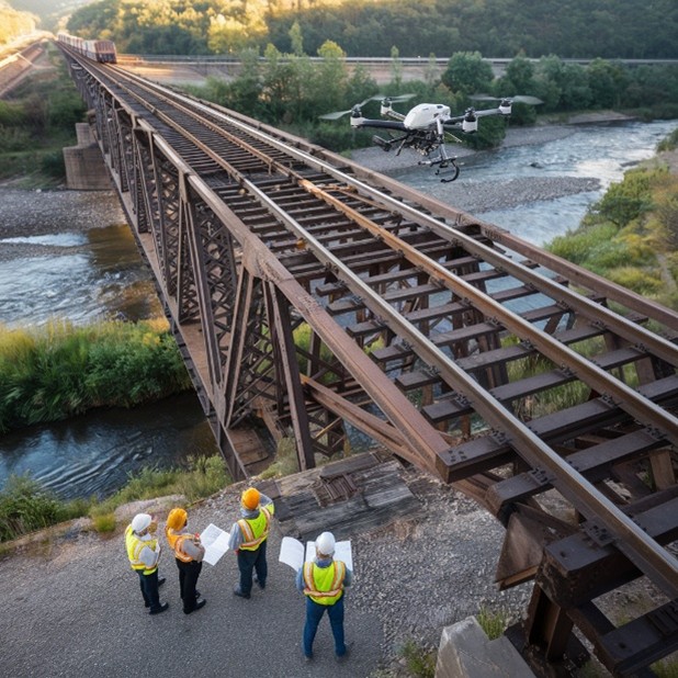
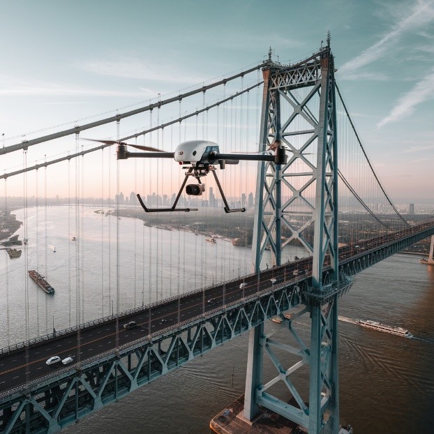
Drone Survey Technology

Our company specializes in drone-based asset inspections that provide highly detailed measurements without human error. Equipped with advanced sensors, our UAVs scan assets, terrain, and stockpiles with unmatched accuracy. The combination of LiDAR, thermal, and orthophoto mapping ensures a comprehensive infrastructure, industrial operations, and material tracking assessment.

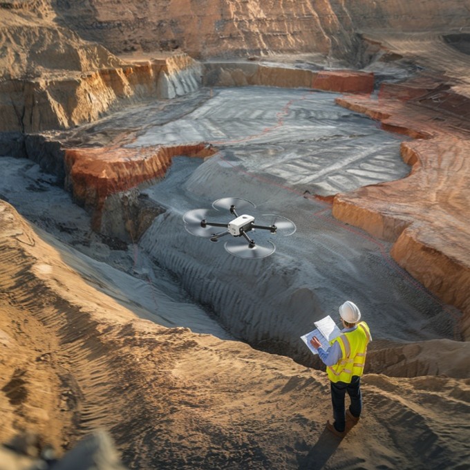
  • High-Resolution Imaging: UAVs generate precise orthophotos, 3D models, and topographic maps. Businesses can analyze land, stockpiles, and structures with absolute accuracy.
  • LiDAR-Based Assessments: Laser scanning provides terrain models, elevation maps, and volumetric estimates. Industries can efficiently track material levels and ground stability.
  • Thermal Data Insights: Infrared imaging detects heat loss, mechanical failures, and pipeline leaks. Early identification of structural weaknesses helps prevent costly breakdowns.
  • Feature image
    Feature image

    Stockpile Measurement Solution

    Drone-based stockpile measurements eliminate errors found in manual surveys. Our volumetric analysis improves inventory accuracy, reduces material loss, and enhances resource planning. AI-driven analytics automate audit reporting, helping industries track stock levels with minimal effort and maximum precision.

  • Precision Volume Calculations: UAVs provide 3D volumetric models of stockpiles for accurate measurement. Manual estimates are eliminated, optimizing inventory management in construction, mining, and agriculture.
  • Dead Stock Identification: Drones detect hidden materials within stockpiles, improving inventory tracking. Preventing unnecessary orders ensures better resource allocation for ongoing projects.
  • Automated Audit Reports: AI processes real-time volumetric data, creating highly accurate reports. Cloud-based tracking simplifies forecasting, auditing, and material stock management.
  • Industries That Benefit

    Mining & Aggregates

    Drone surveys assist in material volume calculations, excavation tracking, and operational planning. Automated measurements help industries reduce inefficiencies and improve resource utilization.

    Construction & Infrastructure

    UAV technology provides real-time land surveys, volumetric assessments, and material tracking. Accurate aerial data enhances site planning, reduces errors, and streamlines project execution.

    Energy & Utilities

    Our company performs solar plant inspections, wind turbine evaluations, and transmission line monitoring. Early fault detection helps prevent failures, minimize risks, and reduce maintenance costs.

    Background Image

    Data Processing Efficiency

    Resources

    Our reports, white papers, and perspectives provide valuable asset estimation insights. These resources help industries streamline evaluations with accurate data and industry-driven analysis.

    Brochure Box

    Anton Solutions’ brochure box includes details on asset estimation, inspections, mapping, and data processing. Download now to explore our advanced technologies and solutions.

    Product Image

    Asset Estimation

    Anton Solutions provides drone-based asset estimation, volumetric analysis, and AI-driven insights for resource planning. Download our brochure to learn more.

    Download
    Product Image

    Data Processing

    We transform drone-collected data into actionable insights, ensuring accurate asset tracking, analysis, and reporting. Get the brochure for full details.

    Download
    Product Image

    Equipment

    Our company uses high-tech UAVs, LiDAR, thermal sensors, and imaging tools for advanced asset assessments. Access our brochure to see the technology.

    Download
    Product Image

    Infrastructure Inspection

    Drones inspect bridges, power lines, and structures, preventing failures through high-resolution imaging and analysis. Grab your brochure copy today.

    Download
    Product Image

    Mapping and Survey

    High-accuracy aerial mapping and surveys provide detailed topographic data for construction, mining, and land assessments. Learn more by downloading our brochure.

    Download
    Product Image

    NDT (Non-Destructive Testing)

    Our UAVs perform non-invasive testing, detecting material defects, structural weaknesses, and safety hazards remotely. Download the brochure for insights.

    Download
    Product Image

    Digital Eye

    Anton Solutions uses drone-mounted cameras for inspections, surveillance, and high-precision data collection. Get the brochure for full details

    Download

    Technology Videos

    Watch our latest technology-related videos and explore new innovations!

    Related Insights

    OUR PARTNERS

    Our trusted partners share our vision for accurate, data-driven, and technology-backed asset estimation solutions. We strive to improve efficiency, reduce costs, and deliver precise results across industries.

    Document